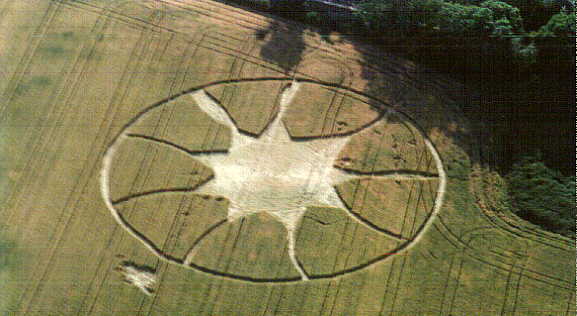
Photo by Nick Nicholson, Crop Circle Archives (Crop Circle Connector)
- Date
- 26 July 1996
- Place
- Blaby, near Countersthrope
- County or region
- Leicestershire
- Country
- England
- Crop
- Wheat
- GPS
- 52.56850, -1.11982
- OS grid reference
- SP 5975 9710
- Nearest ancient site
- Rollright Stones, 72.7 km
Photos5
Photos load from the archives that published them and remain the copyright of their photographers. Crop circle images and reports courtesy The Crop Circle Connector (cropcircleconnector.com). All sources and credits.
Reports
Crop Circle Archives (Crop Circle Connector)
Blaby, Nr Countersthrope, Leicestershire. Reported 26th July. CROP CIRCLES OF 1996 Updated Wednesday 19th October 2005 Blaby, Nr Countersthrope, Leicestershire. Reported 26th July. Ordnance survey grid reference : SP59759710 An aerial shot by Nick Nicholson. The Circular Review. Copyright 1996. Click on thumbnails…
Photos by Nick Nicholson, Michael Newark. Read the full report at Crop Circle Archives.