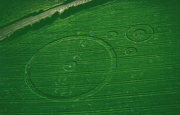
Photo by Steve Alexander, Crop Circle Archives (Crop Circle Connector)
- Date
- 1 June 1998
- Place
- East Kennett (A4 Road), near Avebury
- County or region
- Wiltshire
- Country
- England
- Crop
- Wheat
Photos2
Photos load from the archives that published them and remain the copyright of their photographers. Crop circle images and reports courtesy The Crop Circle Connector (cropcircleconnector.com). All sources and credits.
Reports
Crop Circle Archives (Crop Circle Connector)
East Kennett (A4 Road), Nr Avebury, Wiltshire. Reported 1st June. Commonwealth Network East Kennett (A4 Road), nr Avebury, Wiltshire. Reported 1st June. Updated Thursday 18th June 1998 © 1998 Steve Alexander RING and CIRCLE This formation appeared June 1st in wheat, a mile south-east of Avebury, where the road from…
Photos by Steve Alexander, Peter. Read the full report at Crop Circle Archives.