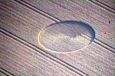
Photo by Russell Stannard, Crop Circle Archives (Crop Circle Connector)
- Date
- 31 July 2001
- Place
- Southfield Farm, near Kettering
- County or region
- Northamptonshire
- Country
- England
- GPS
- 52.37091, -0.70667
- OS grid reference
- SP 881 755
- Nearest ancient site
- Rollright Stones, 73.5 km
Photos3
Photos load from the archives that published them and remain the copyright of their photographers. Crop circle images and reports courtesy The Crop Circle Connector (cropcircleconnector.com). All sources and credits.
Reports
Crop Circle Archives (Crop Circle Connector)
Crop Circle at Southfield Farm, nr Kettering, Northamptonshire. Reported 31st July. Southfield Farm, nr Kettering, Northamptonshire. Reported 31st July. Updated Thursday 2nd August 2001 Images Russell Stannard Copyright 2001. Map ref: SP881755 Medium sized circle just south-east of the A14 and A509 junction.…
Photos by Russell Stannard. Read the full report at Crop Circle Archives.