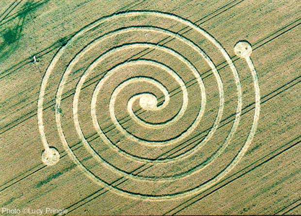
Photo by Lucy Pringle, Crop Circle Archives (Crop Circle Connector)
- Date
- 23 June 2002
- Place
- North Farm, near West Overton
- County or region
- Wiltshire
- Country
- England
- Crop
- Barley
- GPS
- 51.41749, -1.81783
- OS grid reference
- SU 1276 6873
- Nearest ancient site
- The Sanctuary, 1.2 km
- Reference codes
- LP-CCDB uk2002an
Photos11
Photos load from the archives that published them and remain the copyright of their photographers. Crop circle images and reports courtesy The Crop Circle Connector (cropcircleconnector.com). All sources and credits.
Reports
Crop Circle Archives (Crop Circle Connector)
Crop circle at North Farm, nr West Overton, Wiltshire. Reported 23rd June 2002 North Farm, nr West Overton, Wiltshire. Reported 23rd June. Map Ref: GPS SU12766873 Updated Sunday 19th August 2018 Located opposite the Bell Inn, along the A4, this design consists of a double spiral design. Image Lucy Pringle Copyright…
Photos by Lucy Pringle, Stuart Dike. Read the full report at Crop Circle Archives.
Lucy Pringle Crop Circle Photography
Located opposite the Bell Inn, along the A4, this design consists of a double spiral design
Photos by Lucy Pringle. Read the full report at Lucy Pringle.