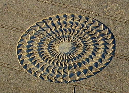
Photo by M.J.Fussell, Crop Circle Archives (Crop Circle Connector)
- Date
- 2 August 2002
- Place
- Windmill Hill (2), near Avebury
- County or region
- Wiltshire
- Country
- England
- Crop
- Wheat
- Reference codes
- LP-CCDB uk2002da
Photos6
Photos load from the archives that published them and remain the copyright of their photographers. Crop circle images and reports courtesy The Crop Circle Connector (cropcircleconnector.com). All sources and credits.
Reports
Crop Circle Archives (Crop Circle Connector)
Crop circle at Windmill Hill (2), nr Avebury, Wiltshire. Reported 2nd August 2002 Windmill Hill (2), nr Avebury, Wiltshire. Reported 2nd August. Map Ref: GPS Updated Thursday 15th August 2002 Image M.J.Fussell Copyright 2002 . Images M.J.Fussell Copyright 2002 A microlight pilot told me of a new circle in a field…
Photos by M.J.Fussell, Bertold.Zugelde. Read the full report at Crop Circle Archives.
Lucy Pringle Crop Circle Photography
Another 'magnetic field' style design, but based on a single central point with radial spokes coming out and forming four rings of 'chevron arrows'
Photos by Lucy Pringle. Read the full report at Lucy Pringle.