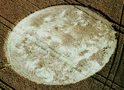
Photo by Andrew King, Crop Circle Archives (Crop Circle Connector)
- Date
- 15 July 2003
- Place
- Camp Field (2), near Middle Woodford
- County or region
- Wiltshire
- Country
- England
- GPS
- 51.13898, -1.85809
- OS grid reference
- SU 1002 3775
- Nearest ancient site
- Stonehenge, 5.0 km
- Reference codes
- LP-CCDB uk2003bp
Photos9
Photos load from the archives that published them and remain the copyright of their photographers. Crop circle images and reports courtesy The Crop Circle Connector (cropcircleconnector.com). All sources and credits.
Reports
Crop Circle Archives (Crop Circle Connector)
Crop Circle at Camp Field (2), Middle Woodford, Wiltshire. Reported 15th July 2003. Camp Field (2), Middle Woodford, Wiltshire. Reported 15th July. Map Ref: SU10023775 (Approx) Updated Tuesday 22nd July 2003 Images Andrew King Copyright 2003 Images M.J.Fussell Copyright 2003 THE BEST FLOOR PATTERN THIS YEAR so…
Photos by Andrew King, M.J.Fussell. Read the full report at Crop Circle Archives.
Lucy Pringle Crop Circle Photography
A circle of standing crop with six flattened thin rings. The outer perimeter is surrounded by two rings of 6 segments, forming 12 petals in total Showing the second formation of a large single circle
Photos by Lucy Pringle. Read the full report at Lucy Pringle.