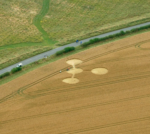
Photo by Nick Nicholson and the Crop Circle Connector, Crop Circle Archives (Crop Circle Connector)
- Date
- 23 July 2003
- Place
- West Woods, near West Overton
- County or region
- Wiltshire
- Country
- England
- GPS
- 51.39782, -1.80662
- OS grid reference
- SU 135 665
- Nearest ancient site
- East Kennett Long Barrow, 1.9 km
Photos1
Photos load from the archives that published them and remain the copyright of their photographers. Crop circle images and reports courtesy The Crop Circle Connector (cropcircleconnector.com). All sources and credits.
Reports
Crop Circle Archives (Crop Circle Connector)
Crop Circle at West Woods, nr West Overton, Wiltshire. Reported 23rd July 2003. West Woods, nr West Overton, Wiltshire. Reported 23rd July. Map Ref: SU135665 Updated Friday 25th July 2003 Image Nick Nicholson and the Crop Circle Connector Copyright 2003 There is another formation identical to the one I reported…
Photos by Nick Nicholson and the Crop Circle Connector. Read the full report at Crop Circle Archives.