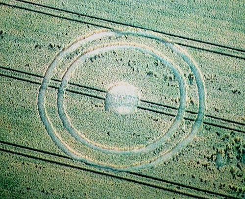
Photo by Russell Stannard, Crop Circle Archives (Crop Circle Connector)
- Date
- 30 June 2004
- Place
- Meppershall Road, near Shillington
- County or region
- Bedfordshire
- Country
- England
- Crop
- Wheat
- GPS
- 52.00598, -0.35444
- OS grid reference
- TL 130 354
- Nearest ancient site
- Rollright Stones, 83.4 km
Photos3
Photos load from the archives that published them and remain the copyright of their photographers. Crop circle images and reports courtesy The Crop Circle Connector (cropcircleconnector.com). All sources and credits.
Reports
Crop Circle Archives (Crop Circle Connector)
Crop Circle at Meppershall Road, Shillington, Bedfordshire. Reported 30th June 2004. Meppershall Road, Shillington, Bedfordshire. Reported 30th June. Map Ref: TL130354 Updated Monday 26th July 2004 Image Russell Stannard Copyright 2004 Images Matt Copyright 2004 With reference to the rumour of the circle near…
Photos by Russell Stannard, Matt. Read the full report at Crop Circle Archives.