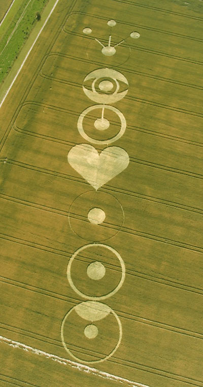
Photo by Francine Blake, Crop Circle Archives (Crop Circle Connector)
- Date
- 22 July 2004
- Place
- Pewsey White Horse (3), near Pewsey
- County or region
- Wiltshire
- Country
- England
- Crop
- Wheat
- GPS
- 51.32221, -1.76102
- OS grid reference
- SU 167 581
- Nearest ancient site
- Knap Hill, 6.2 km
- Reference codes
- LP-CCDB uk2004bm
Photos13
Photos load from the archives that published them and remain the copyright of their photographers. Crop circle images and reports courtesy The Crop Circle Connector (cropcircleconnector.com). All sources and credits.
Reports
Crop Circle Archives (Crop Circle Connector)
Crop Circle at Pewsey White Horse (3), nr Pewsey, Wiltshire. Reported 22nd July 2004. Pewsey White Horse (3), nr Pewsey, Wiltshire. Reported 22nd July. Map Ref: SU16855829 GPS Updated Thursday 5th August 2004 Image Francine Blake Copyright 2004 7 CHAKRAS Discuss this Crop Circle on the Forum Images Steve Alexander…
Photos by Francine Blake, Steve Alexander, Marianne Wyss, Julian Gibsone, Steve, Chris Watt. Read the full report at Crop Circle Archives.
Lucy Pringle Crop Circle Photography
A long pictogram style formation of circles and arcs
Photos by Lucy Pringle. Read the full report at Lucy Pringle.