Crop Circle Archives (Crop Circle Connector)
- Date
- 8 August 2004
- Place
- Shalbourne, near Hungerford
- County or region
- Wiltshire
- Country
- England
- GPS
- 51.37370, -1.53950
- OS grid reference
- SU 321 639
- Nearest ancient site
- Martinsell Hill, 12.4 km
- Reference codes
- LP-CCDB uk2004cp
Photos15
Photos load from the archives that published them and remain the copyright of their photographers. Crop circle images and reports courtesy The Crop Circle Connector (cropcircleconnector.com). All sources and credits.
Reports
Crop Circle Archives (Crop Circle Connector)
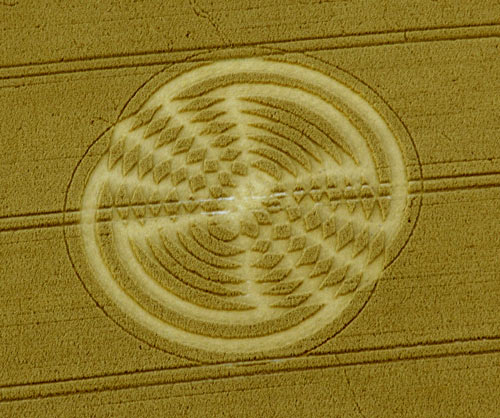
Crop Circle at Shalbourne, nr Hungerford, Wiltshire. Reported 8th August 2004. Shalbourne, nr Hungerford, Wiltshire. Reported 8th August. Map Ref: SU321639 Updated Monday 16th August 2004 Images CCC Copyright 2004 Discuss this Crop Circle on the Forum Images Steve Alexander Copyright 2004 Diagram Alex (X-Cosmos)…
Photos by Steve Alexander, Alex (X-Cosmos), Andreas Muller, Daniel Vidler. Read the full report at Crop Circle Archives.
Lucy Pringle Crop Circle Photography
A complex design based upon hexagonal geometry
Photos by Lucy Pringle. Read the full report at Lucy Pringle.