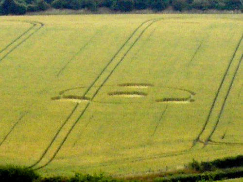
Photo by Andrew King, Crop Circle Archives (Crop Circle Connector)
- Date
- 6 July 2005
- Place
- Meopham Station, near Sole Stree
- County or region
- Kent
- Country
- England
- Crop
- Wheat
- GPS
- 51.39146, 0.35218
- OS grid reference
- TQ 637 684
- Nearest ancient site
- Long Man of Wilmington, 65.6 km
Photos15
Photos load from the archives that published them and remain the copyright of their photographers. Crop circle images and reports courtesy The Crop Circle Connector (cropcircleconnector.com). All sources and credits.
Reports
Crop Circle Archives (Crop Circle Connector)
Crop Circle at Meopham Station, nr Sole Stree, Kent. Reported 6th July 2005 Meopham Station, nr Sole Street, Kent. Reported 6th July. Map Ref: APPROX TQ637684 Updated Saturday 6th August 2005 This is to report (confirm) sighting of a new formation off of A227 nr Meopham Station, Kent. I believe this formation was…
Photos by Andrew King, Graham Tucker, Andy Fowlds. Read the full report at Crop Circle Archives.