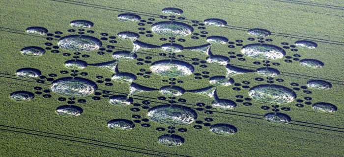
Photo by Chris Bird, Crop Circle Archives (Crop Circle Connector)
- Date
- 25 June 2010
- Place
- White Sleet Hill, near Mere
- County or region
- Wiltshire
- Country
- England
- GPS
- 53.80065, -4.06494
- Nearest ancient site
- Rollright Stones, 263.0 km
Photos61
Photos load from the archives that published them and remain the copyright of their photographers. Crop circle images and reports courtesy The Crop Circle Connector (cropcircleconnector.com). All sources and credits.
Reports
Crop Circle Archives (Crop Circle Connector)
Crop Circle at White Sleet Hill, Nr Mere, Wiltshire. Reported 25th June 2010. White Sheet Hill, Nr Mere, Wiltshire. Reported 25th June. Map Ref: HERE This Page has been accessed Updated Wednesday 25th August 2010 AERIAL SHOTS GROUND SHOTS DIAGRAMS FIELD REPORTS COMMENTS ARTICLES 01/07/10 25/07/10 14/07/10 27/06/10…
Photos by Chris Bird, John Montgomery, Alexander, Olivier Morel, Lucy Pringle, Tommy Borms, Andreas Muller, Bertold Zugelder, Yan Sun, Arie Van Der Wijst, Combine of Light, Jay Goldner, Nyako Nakar, Graham Lamat, Free spirit, www.apjimages.co.uk, Holly Lowrey. Read the full report at Crop Circle Archives (5 pages).