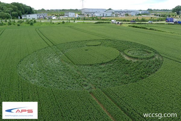
Photo by Wccsg ', Crop Circle Archives (Crop Circle Connector)
- Date
- 17 June 2012
- Place
- Berkley Lane, near Frome
- County or region
- Somerset
- Country
- England
- Crop
- Wheat
- GPS
- 51.24297, -2.28861
- OS grid reference
- ST 799 493
- Nearest ancient site
- Cley Hill, 5.6 km
Photos58
Photos load from the archives that published them and remain the copyright of their photographers. Crop circle images and reports courtesy The Crop Circle Connector (cropcircleconnector.com). All sources and credits.
Reports
Crop Circle Archives (Crop Circle Connector)
Crop Circle at Berkley Lane, nr Frome. Somerset. Reported 17th June 2012. Berkley Lane, nr Frome. Somerset. Reported 17th June. Map Ref: ST799493 This Page has been accessed Updated Wednesday 22nd August 2012 AERIAL SHOTS GROUND SHOTS DIAGRAMS FIELD REPORTS COMMENTS ARTICLES 17/06/12 08/07/12 21/06/12 17/06/12…
Photos by Wccsg ', Stephen Hobbs, Terry Lawrence, Peter Goldstein, Luke Edwards, Zugelder, Nyako Nakar, Jay Goldner, www.maya48.com, Antonio Reyes, Johan Andersson, Stuart Dike, David Tarr, Jake, Patrice MARTY, Shaun Cooper. Read the full report at Crop Circle Archives (6 pages).