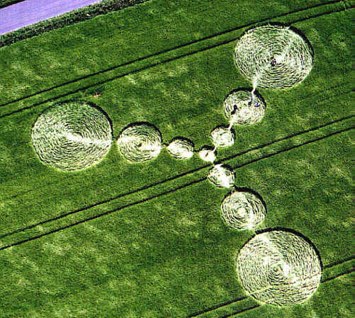
Photo by Steve Alexander, Crop Circle Archives (Crop Circle Connector)
- Date
- 8 June 2000
- Place
- Grafton Down, near Wexcombe
- County or region
- Wiltshire
- Country
- England
- Crop
- Barley
- GPS
- 51.32107, -1.61975
- OS grid reference
- SU 2659 5806
- Nearest ancient site
- Martinsell Hill, 9.0 km
- Reference codes
- LP-CCDB uk2000ao
Photos17
Photos load from the archives that published them and remain the copyright of their photographers. Crop circle images and reports courtesy The Crop Circle Connector (cropcircleconnector.com). All sources and credits.
Reports
Crop Circle Archives (Crop Circle Connector)
Grafton Down, nr Wexcombe, Wiltshire. Reported 8th June. ContentZone CROP CIRCLES IN 2000 Grafton Down, nr Wexcombe, Wiltshire. Reported 8th June. GPS Reference SU26595806 Updated Wednesday 14th June 2000 Click on thumbnails to enlarge. Images Steve Alexander Copyright 2000 Images Stuart Dike Copyright 2000 Click…
Photos by Steve Alexander, Stuart Dike, Frances Mallett, Peter Sorensen. Read the full report at Crop Circle Archives.
Lucy Pringle Crop Circle Photography
A three point design consisting of 10 incrementally sized circles in each 'arm' A three point design consisting of 10 incrementally sized circles in each 'arm'
Photos by Lucy Pringle. Read the full report at Lucy Pringle.