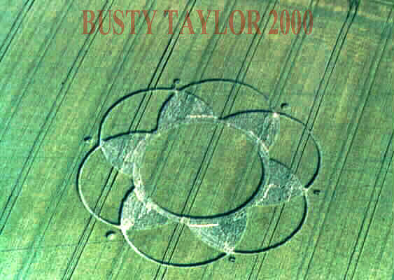
Photo by M.J.Fussell, Crop Circle Archives (Crop Circle Connector)
- Date
- 12 June 2000
- Place
- Pack Lane, near East Oakley, Basingstoke
- County or region
- Hampshire
- Country
- England
- Crop
- Barley
- GPS
- 51.25511, -1.14813
- OS grid reference
- SU 5954 5100
- Nearest ancient site
- Danebury Hillfort, 30.1 km
- Reference codes
- LP-CCDB uk2000ar
Photos6
Photos load from the archives that published them and remain the copyright of their photographers. Crop circle images and reports courtesy The Crop Circle Connector (cropcircleconnector.com). All sources and credits.
Reports
Crop Circle Archives (Crop Circle Connector)
Pack Lane, East Oakley, nr Basingstoke. Hampshire. Reported 12th June. ContentZone CROP CIRCLES IN 2000 Pack Lane, East Oakley, nr Basingstoke. Hampshire. Reported 12th June. GPS Reference SU59545100 Updated Friday 30th June 2000 Image M.J.Fussell Copyright 2000 Diagram Gary Keel Copyright 2000 ( This is the East…
Photos by M.J.Fussell, Gary Keel, Peter Sorensen. Read the full report at Crop Circle Archives.
Lucy Pringle Crop Circle Photography
A flower-shaped pattern approx 230' dia
Photos by Lucy Pringle. Read the full report at Lucy Pringle.