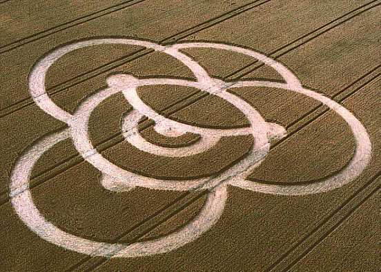
Photo by Steve Alexander, Crop Circle Archives (Crop Circle Connector)
- Date
- 25 July 2000
- Place
- Bishop Cannings (2), near Devizes
- County or region
- Wiltshire
- Country
- England
- Crop
- Wheat
- GPS
- 51.38246, -1.95404
- OS grid reference
- SU 0329 6482
- Nearest ancient site
- Cherhill White Horse, 5.1 km
- Reference codes
- LP-CCDB uk2000cz
Photos20
Photos load from the archives that published them and remain the copyright of their photographers. Crop circle images and reports courtesy The Crop Circle Connector (cropcircleconnector.com). All sources and credits.
Reports
Crop Circle Archives (Crop Circle Connector)
Bishop Cannings (2), nr Devizes, Wiltshire. Reported 25th July. Bishop Cannings (2), nr Devizes, Wiltshire. Reported 25th July. GPS Reference SU03296482 Updated Wednesday 27th September 2000 Image Steve Alexander Copyright 2000 Video Image Masao Maki Copyright 2000 Click on right-hand side formation to see report.…
Photos by Steve Alexander, Masao Maki, M.J.Fussell, Stuart Dike & M.J.Fussell, Stuart Dike. Read the full report at Crop Circle Archives.
Lucy Pringle Crop Circle Photography
Five overlapping rings, each appearing to 'go behind' the others Five overlapping rings, each appearing to 'go behind' the others
Photos by Lucy Pringle. Read the full report at Lucy Pringle.