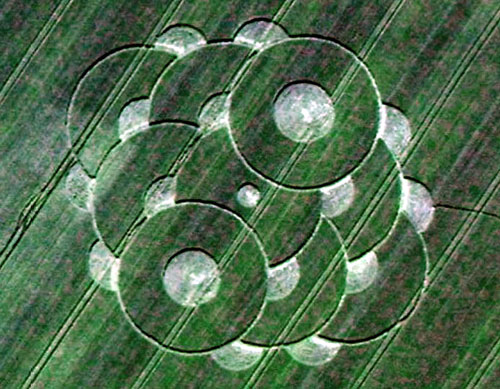
Photo by Chris Watt, Crop Circle Archives (Crop Circle Connector)
- Date
- 18 June 2005
- Place
- Burwell, near Louth
- County or region
- Lincolnshire
- Country
- England
- Crop
- Barley
- GPS
- 53.29470, 0.03078
- OS grid reference
- TF 354 794
- Nearest ancient site
- Rollright Stones, 182.2 km
Photos8
Photos load from the archives that published them and remain the copyright of their photographers. Crop circle images and reports courtesy The Crop Circle Connector (cropcircleconnector.com). All sources and credits.
Reports
Crop Circle Archives (Crop Circle Connector)
Crop Circle at Burwell, nr Louth, Lincolnshire. Reported 18th June 2005 Burwell, nr Louth, Lincolnshire. Reported 18th June. Map Ref: APPROX TF354794 Updated Saturday 24th May 2008 Stretched Images Chris Watt Copyright 2005 Image Suzanne Barker Copyright 2005 Images Clare Latimer Copyright 2005 Hi, I live in…
Photos by Chris Watt, Suzanne Barker, Clare Latimer, Steven Fuller, Laurence Winram. Read the full report at Crop Circle Archives.