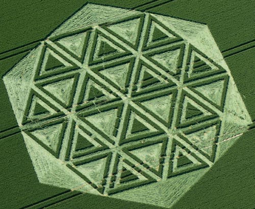
Crop Circle Archives (Crop Circle Connector)
- Date
- 23 June 2005
- Place
- Avebury Trusloe, near Beckhampton
- County or region
- Wiltshire
- Country
- England
- Crop
- Wheat
- GPS
- 51.43285, -1.87156
- OS grid reference
- SU 0902 7043
- Nearest ancient site
- Windmill Hill, 0.9 km
- Reference codes
- LP-CCDB uk2005ax
Photos38
Photos load from the archives that published them and remain the copyright of their photographers. Crop circle images and reports courtesy The Crop Circle Connector (cropcircleconnector.com). All sources and credits.
Reports
Crop Circle Archives (Crop Circle Connector)
Crop Circle at Avebury Trusloe, nr Beckhampton, Wiltshire. Reported 23rd June 2005 Avebury Trusloe, nr Beckhampton, Wiltshire. Reported 23rd June. Map Ref: SU09027043 Crop: Wheat Updated Monday 8th August 2005 Tony Hughes from The Wiltshire Microlight Centre was the first person to spot this crop circle early on…
Photos by Steve Alexander, Mike Callahan, Bertold Zugelder, Lucy Pringle, John Dove, Michael Murray, Debbie Davis. Read the full report at Crop Circle Archives (2 pages).
Crop Circle Archives (Crop Circle Connector)
Crop Circle at Silbury Hill, nr Avebury,Wiltshire. Reported 26th June 2005 Silbury Hill, nr Avebury,Wiltshire. Reported 26th June. Map Ref: SU09806832 Crop: Barley Updated Wednesday 29th June 2005 Small formation appears in wonderful setting of Silbury Hill. This intimate and delicate formation that has appeared so…
Read the full report at Crop Circle Archives (2 pages).
Lucy Pringle Crop Circle Photography
A circle containing a standing crescent of crop with a small circle overlapping one side and two grapeshot circles at opposite ends of the main design A circle containing a standing crescent of crop with a small circle overlapping one side and two grapeshot circles at opposite ends of the main design
Photos by Lucy Pringle. Read the full report at Lucy Pringle.